| Home > All By Location regional map > Pittsburgh West > Sixth Street Bridge 1892-1927 | ||||
|
|
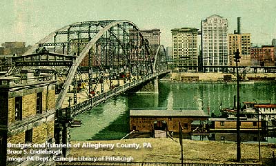
Postcard view toward downtown 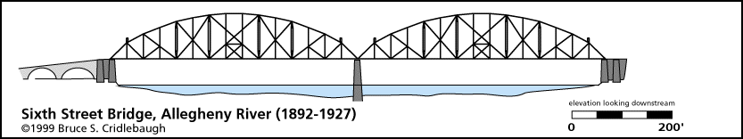
Elevation drawing looking downstream
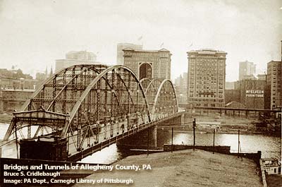
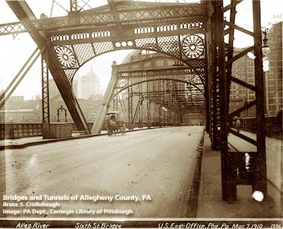
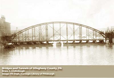
OFFICIAL NAME: OTHER DESIGNATION: Sixth Street Bridge, St. Clair Street Bridge LOCATION: Pittsburgh USGS 7.5" Topo Quad - UTM Coordinates: Pittsburgh West - Zone 17; 0584 4477 CARRIED: motor vehicles, street cars BETWEEN: -- Federal St [Franklin Rd] on right descending bank of Allegheny River -- Sixth St [St. Clair St] on left descending bank of Allegheny River CROSSED: -- Allegheny River at mile 0.5 TYPE OF CONSTRUCTION / DESIGN: subdivided Pratt (modified Pennsylvania/Petit) through truss LENGTH OF MAIN SPAN: (north to south) 48.5 ft; two main spans of 439.0 ft each; 105 ft approach with two 28 ft archways 40 ft wide roadway, with two 10 ft sidewalks TOTAL LENGTH (including longest elevated ramp): 1,032.5 ft HEIGHT OF DECK: YEAR ERECTED / ENGINEER: 1892, Theodore Cooper; replaced 1927 (trusses moved to Ohio River back channel between Coraopolis and Neville Island) Drake & Stratton Company, Ltd, foundations and masonry Union Bridge Company, superstructure Baird Brothers of Pittsburgh, erection ADDITIONAL INFO: Replaced the 1857 Roebling suspension bridge. Declared a toll-free bridge 16 March 1911. The 1892 Sixth Street Bridge (a pair of camelback Pratt trusses and the third bridge built in this location) had a second chance. In 1927, it was lowered from its piers, the top chords partially disassembled. The structure was floated downriver to a new location over the Ohio River back channel between Coraopolis and Neville Island to make way for the current structure. After nearly 50 years of additional service, which included weight restrictions and closings during cold weather, the old bridge was replaced by a deck girder bridge which was completed in 1995. Sixth St was formerly St. Clair St in Pittsburgh; it aligns with Federal St (formerly Franklin Rd which connected to the Venango Path) in the former city of Allegheny (Northside). Historic American Engineeering Record (HAER): view page - Coraopolis Bridge 1892-1927; Sixth St Bridge 1927-1986 (HAER PA-217); P.A.C. Spero & Company, 1989 view page - "Three Sisters" Bridges -- Historic American Engineering Record document FIELD CHECKED: INFO SOURCES: Lorant, "Pittsburgh"; Smith, "Pittsburgh: Then and Now" Submit info or inquiry - share some facts or ask a question. Introduction -- Nearby Structures Page created: Last modified: 04-Nov-2000 |
View Larger Map 
| ||
| copyright: © Bruce S. Cridlebaugh 1999-2008 All Rights Reserved | ||||