| ||||
| Home > All By Location regional map > Ambridge > Neville Island - Corapolis Bridge 1927-1986 | ||||
|
|
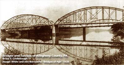
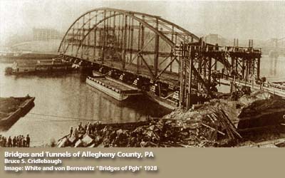
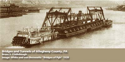
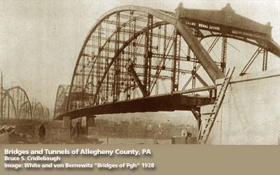
1928 photo with 1894 Neville Island - Coraopolis Bridge in background 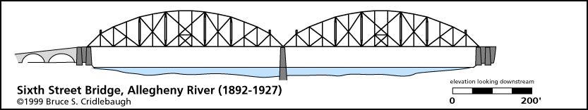
OFFICIAL NAME: OTHER DESIGNATION: Coraopolis Bridge Neville Island - Coraopolis Bridge ambr571-18x LOCATION: Coraopolis - Neville Twp USGS 7.5" Topo Quad - UTM Coordinates: Ambridge - Zone 17; 0571 4485 CARRIES: BETWEEN: -- Grand Av (Neville Twp) -- [PA51] (Coraopolis) CROSSES: -- Ohio River back channel at Mile 9.6 -- CSX RR [PLE RR] TYPE OF CONSTRUCTION / DESIGN: steel through truss, two spans LENGTH OF MAIN SPAN: 2 main spans of 439.0 ft each TOTAL LENGTH (including longest elevated ramp): HEIGHT OF DECK: 45.5 ft YEAR ERECTED / ENGINEER: 1892, moved to this location 1927, replaced 1986 ADDITIONAL INFO: This was the old Sixth Street Bridge from downtown Pittsburgh. It joined St. Clair St (Sixth St, downtown) and Federal St (North Side) from 1892-1927. It was partially dismantled and re-erected in this location. The first bridge (1894-1927) was one of two built to allow a streetcar connection between Coraopolis (Middletown) and Pittsburgh via Neville Island (Montour Island). The 1894 bridge appears in the background of the top photo. Historic American Engineeering Record (HAER): view page - Coraopolis Bridge 1892-1927; Sixth St Bridge 1927-1994 (HAER PA-217); P.A.C. Spero & Company, 1989 FIELD CHECKED: INFO SOURCES: Submit info or inquiry - share some facts or ask a question. Introduction -- Nearby Structures Page created: 03-Jan-2003 Last modified: 03-Jan-2003 |
View Larger Map 
| ||
| copyright: © Bruce S. Cridlebaugh 1999-2008 All Rights Reserved | ||||