|
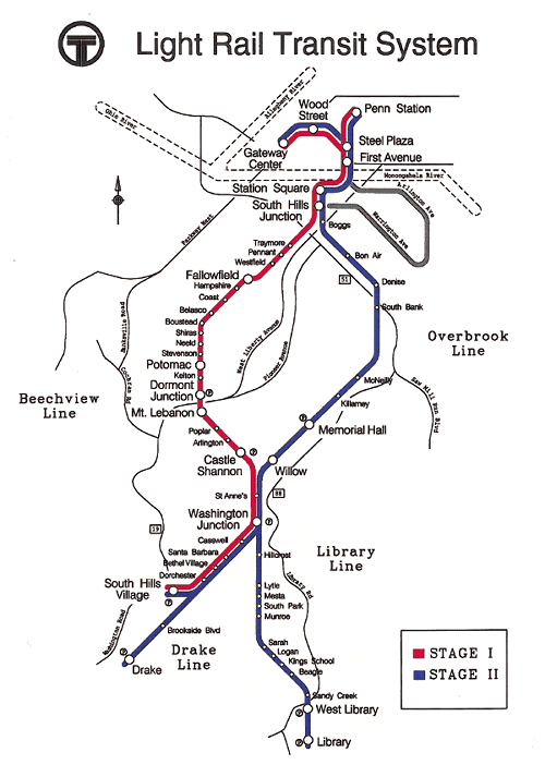
Map of Port Authority "T" light rail system (Port Authority)
|
|
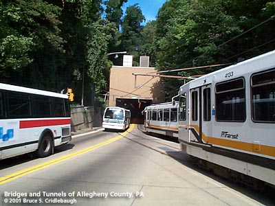
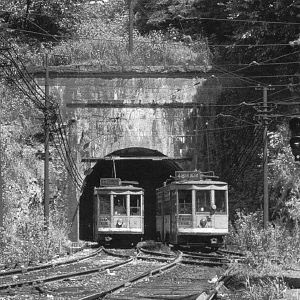
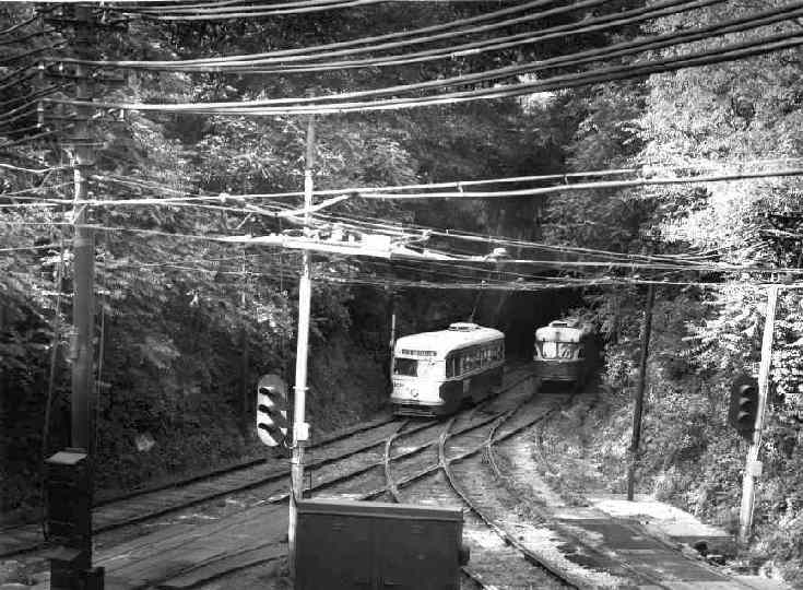
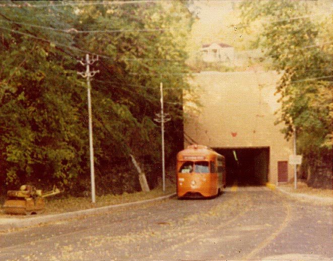
Two views of Southern portal at South Hills Junction;
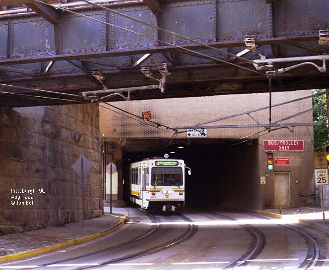
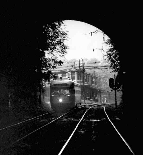
Northern portal at Carson St and Smithfield St (Jon Bell 1999);
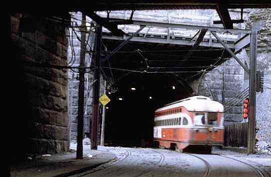
Northern portal at Carson St and Smithfield St (Bill Vigrass historical photo)
|
|
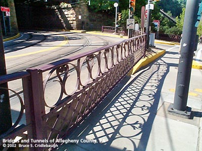
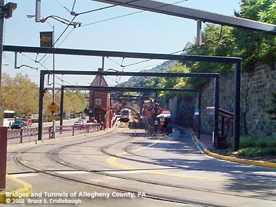
Near northern portal at Carson St and Smithfield St:
Railing salvaged from Brady St Bridge;
Two views of Station Square "T" station
|
|
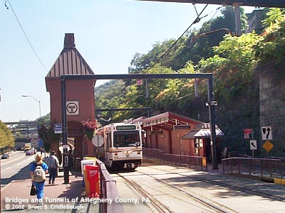
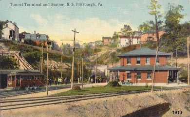
South Hills Junction:
View south on Knoxville (Allentown) line, LRV on right on tunnel line;
View north from steps to Warrington Av -- tunnel at center in distance;
View north from platform near Overbrook line -- tunnel at center in distance;
1910 postcard view from Overbrook line
|

|
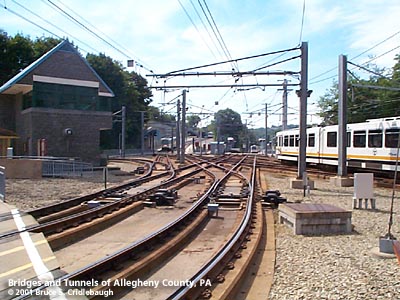
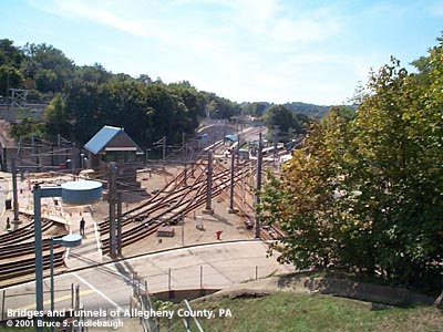
View south from steps to Secane Av -- Busway to Warrington Av in front;
"A view of the trackwork at South Hills Junction, seen from the hillside to the north. The train at the station at upper right is headed south towards Beechview on route 42S or 42L. The tracks at the top lead to the currently-suspended "Overbrook route" once used by PCCs to reach Castle Shannon, Library and Drake. The tracks at lower left carry Route 52 to Warrington Avenue, and the tracks at lower right enter the Mt. Washington tunnel." (Jon Bell)
|
|
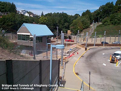
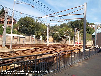
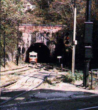
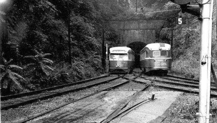
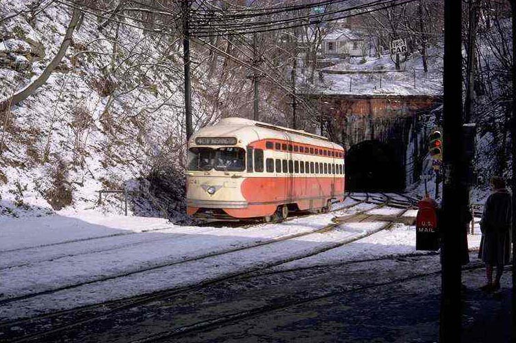
South Hills Junction:
Early view of southern portal;
Pay-As-You-Enter (PAYE) car M540, 1940s (Bill Vigrass photo);
May 31, 1957 (Ed Miller photo);
(Ed Torpey photo)
|
|
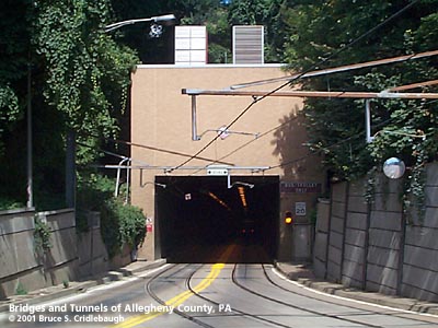
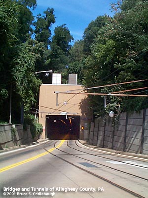
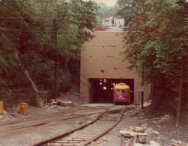
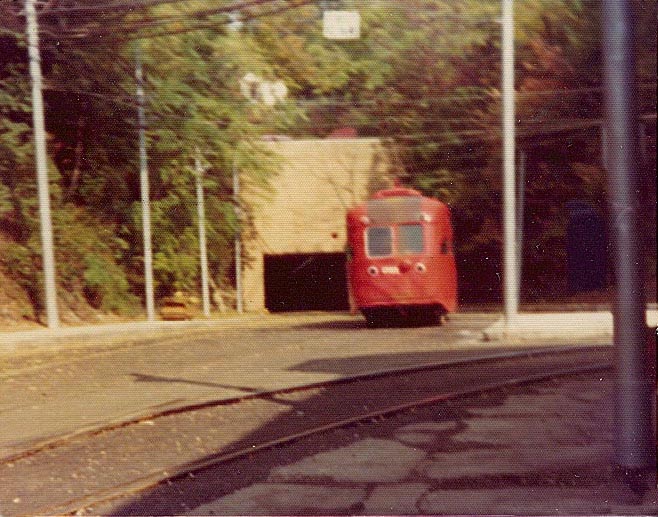
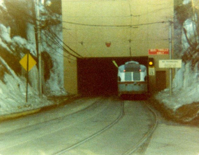
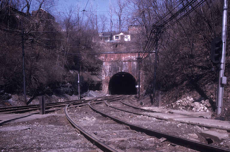
Southern portal (Larry Woods photos):
Upgrading the tunnel to allow bus traffic began in late 1973, with one track closed at a time. [May 1975]
Two views in 1976;
February 1978
|
|
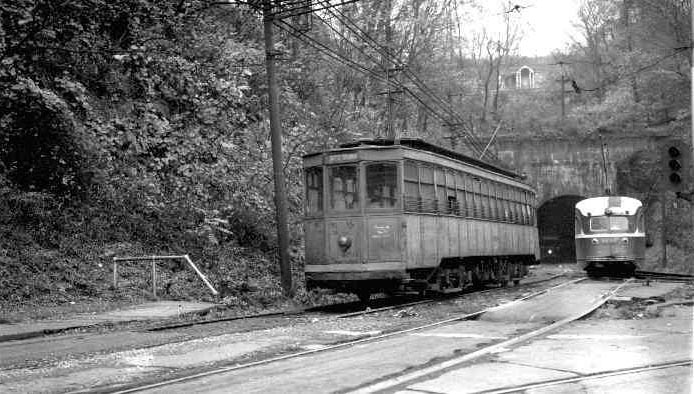
South Hills Junction:
Interurban car from the Drake line, 1958 (Fred W. Schneider III photo);
(Bill Vigrass photo);
1700 series PCC car, 1962 (Bill Vigrass photo);
(Bob Schmidt collection)
|