| Home > All By Location regional map > Pittsbugh East > Brady St Bridge 1896-1976 | ||||
|
|
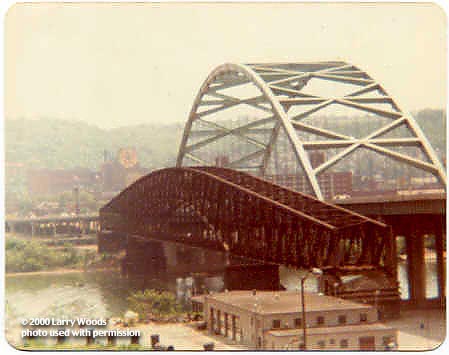
1978 photo (Larry Woods) 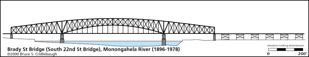
Elevation drawing looking downstream
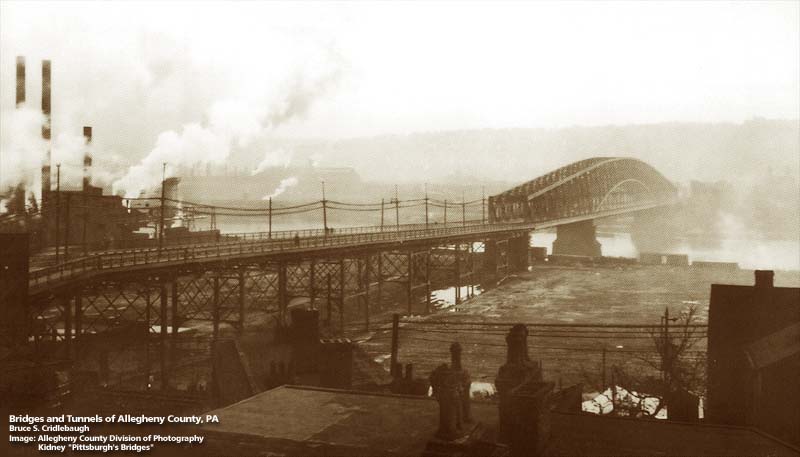
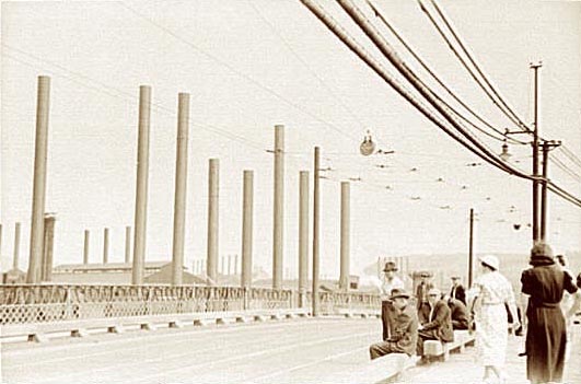
South Twenty-Second Street Bridge OTHER DESIGNATION: Brady Street Bridge pghe587-22x LOCATION: Pittsburgh USGS 7.5" Topo Quad - UTM Coordinates: Pittsburgh East - Zone 17; 0587 4476 CARRIED: motor vehicles, two lanes street railway BETWEEN: -- Second Av at Brady St, Pittsburgh, on right descending bank of Monongahela River -- East Carson St, Pittsburgh (Birmingham), on left descending bank of Monongahela River CROSSED: -- (RDB to LDB) Monongahela River at mile 2.4 TYPE OF CONSTRUCTION / DESIGN: through truss LENGTH OF MAIN SPAN: TOTAL LENGTH (including longest elevated ramp): HEIGHT OF DECK: YEAR ERECTED / ENGINEER: 1895-96, Albert Louis Schultz ADDITIONAL INFO: Albert Louis Schultz is also noted as the designer of bridges in Schenley Park, the Mount Washington Freight Incline (Monongahela Incline), Mount Oliver Incline, New Kensington Bridge (Allegheny River) and first Highland Park Bridge (Allegheny River), consulting engineer on the first Glenwood Bridge (Monongahela River). He organized the Schultz Bridge Co which was absorbed by American Bridge. He also managed projects for the West End Traction Co and West Side Belt RR and was deisgner and estimator for the Iron City Bridge Co. More info is also here. (Historic American Engineering Record) Replaced 1976, by the Birmingham Bridge. FIELD CHECKED: INFO SOURCES: USACE Monongahela River Nav. Charts; "HAER: Pittsburgh Bridges at the Point"; Pittsburgh Gazette Times, "Story of Pittsburgh and vicinity", 1908 Submit info or inquiry - share some facts or ask a question. Introduction -- Nearby Structures Page created: 29-Aug-2001 Last modified: 25-Dec-2013 |
View Larger Map 
| ||
| copyright: © Bruce S. Cridlebaugh 1999-2008 All Rights Reserved | ||||