| Home > All By Location regional map > Donora > Sutersville Bridge c1900-1986 | ||||
|
|
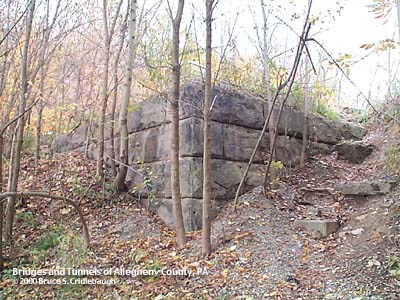
Abutment on left downstream bank
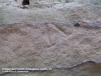
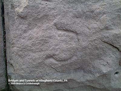
OFFICIAL NAME: Sutersvillle Bridge OTHER DESIGNATION: LOCATION: Elizabeth Twp, Allegheny Co. - Sutersville, Westmoreland Co. USGS 7.5" Topo Quad - UTM Coordinates: Donora - Zone 17; 0601 4455 CARRIES: motor vehicles, two lanes BETWEEN: -- First St (Sutersville) on right descending bank of Youghiogheny River -- Douglass Run Rd and Blythedale Rd (Douglass, Elizabeth Twp) on left descending bank of Youghiogheny River CROSSED: -- (RDB to LDB) Youghiogheny River at mile 14.5 TYPE OF CONSTRUCTION / DESIGN: LENGTH OF MAIN SPAN: TOTAL LENGTH (including longest elevated ramp): HEIGHT OF DECK: YEAR ERECTED / ENGINEER: c1900 ADDITIONAL INFO: Replaced by current structure in 1986. Stone abutment from western end of bridge is adjacent upstream from the current bridge. Stonecutters marks, used as proof of an individual's work on payday, may be found on many of the abutment stones. A battery of beehive coke ovens was located just downstream at the outflow of Douglass Run into the Youghiogheny River. FIELD CHECKED: 23-Oct-2000 INFO SOURCES: Submit info or inquiry - share some facts or ask a question. Introduction -- Nearby Structures Page created: Last modified: 30-Oct-2000 |
View Larger Map 
| ||
| copyright: © Bruce S. Cridlebaugh 1999-2008 All Rights Reserved | ||||