| Home > All By Location regional map > Valencia > Dickey Rd over West Branch Deer Creek | ||||
|
|
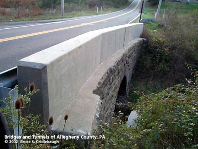
View east of northern (upstream) wall
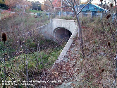
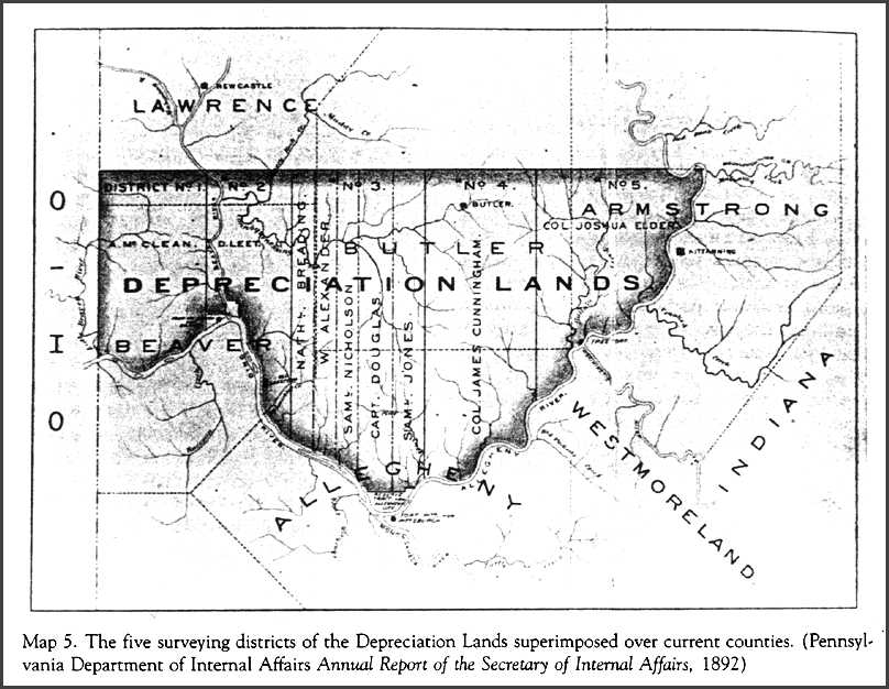
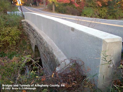
OFFICIAL NAME: OTHER DESIGNATION: Dickey Rd over West Branch Deer Creek vale589-4 LOCATION: Richland USGS 7.5" Topo Quad - UTM Coordinates: Valencia - Zone 17; 0589 4499 CARRIES: -- Dickey Rd [Twp. Rd. No. 709] BETWEEN: -- east of intersection of Dickey Rd and Meridian Rd -- Stillwater Dr CROSSES: -- West Branch Deer Creek TYPE OF CONSTRUCTION / DESIGN: stone arch locally-quarried sandstone outer spandrel wall: rock-faced coursed ashlar upper walls and parapets: replaced with concrete wall arch ring: dressed voussoirs in segmental arch widened to the south southern stonework replaced with concrete pipe culvert LENGTH OF MAIN SPAN: TOTAL LENGTH (including longest elevated ramp): HEIGHT OF DECK: YEAR ERECTED / ENGINEER: c1870-1900, County of Allegheny? widened and altered ADDITIONAL INFO: During years surrounding 1900, Allegheny County, under the direction of County Engineer Charles Davis, was busy throughout the county building stone arch bridges of a simple and similar design. This bridge exhibits the more common design features of the County's stone bridges. The design and construction details match many others still standing elsewhere in the county. But in this instance, the widening of the road forced the altering of the bridge. Only the lower portion of the stone arch and abutments remain visible on the northern (upstream) side. Dickey Rd connects Gibsonia with Bakerstown. The 1889 History of Allegheny County gives a biography of Robert B. Dickey, a farmer near Gibsonia. It reports the family beginning with David Dickey immigrating from Ireland in 1795. His son, John, is shown on the Warantee Atlas as owning eleven parcels of about 200 acres each in the Depreciation Lands patented in 1786. Territory north of the Allegheny River was purchased by the PA General Assembly in 1784 and was offered for sale in 1785 as Depreciation Land to redeem certificates given to Pennsylvania's Revolutionary War soldiers to compensate them for having received pay in depreciated currency. Large parts of the area remained unsettled after their purchase by speculators from eastern Pennsylvania. John Dickey's parcels stretched across Richland, Hampton, West Deer, Indiana and Harmar townships. The northernmost parcel straddled the border of Richland and Hampton townships near the intersection of PA8 and the PA Turnpike. The biography states John Dickey moved to the area to settle in 1831. His son, Robert, had four children including one, John C. Dickey. The 1876 Atlas of the county shows Jno. Dickey's home on Dickey Rd east of Meridian Rd -- near the site of the small stone bridge. To the south, near the post office on Ewalt Rd, was Wm. Dickey's home, "Gurtis Knob." The site of the stone bridge was originally patented to Simon Fishbaugh in 1786 in one of his parcels called "Plumb Field." From 1907 to 1932, the Pittsburgh and Butler Street Railway operated the Butler Shortline interurban service. The line roughly followed PA8 to Ewalt Rd where it turned to parallel to Meridian Rd. Scheduled stops included Valencia, State Road, Bakerstown Station, St. Barnabas, McKelvy's, Dickey's, Austin's, Girty's, Hardies Road and Sample. Dickey's Stop was near the intersection of Dickey Rd and Meridian Rd.; Summit St marks a part of the route. A sign marks the crossing at Gibsonia Rd and the right-of-way can still be seen there. FIELD CHECKED: 3-Nov-2002 INFO SOURCES: field check; Atlas of Allegheny County, 1876; Warantee Atlas of Allegheny, 1911; Warner, "History of Allegheny County," 1889; PA Museum and Historical Commision; Joel Fishman, Ph. D., "Historical Sketch to Land Titles in Western Pennsylvania"; Richland Twp History website Submit info or inquiry - share some facts or ask a question. Introduction -- Nearby Structures Page created: Last modified: 13-Feb-2003 |
View Larger Map 
| ||
| copyright: © Bruce S. Cridlebaugh 1999-2008 All Rights Reserved | ||||