| Home > All By Location regional map > Pittsburgh West > Monongahela Bridge 1846-1881 | ||||
|
|
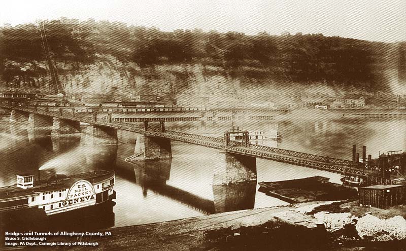
View toward Mt Washington 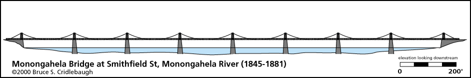
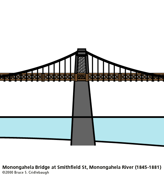
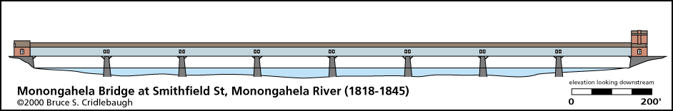
Elevation drawing looking downstream
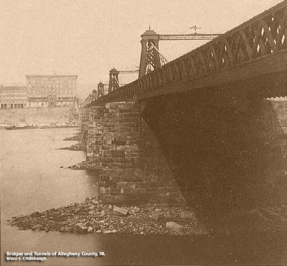
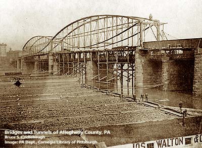
Monongahela Suspension Bridge Smithfield Street Bridge OTHER DESIGNATION: LOCATION: Pittsburgh USGS 7.5" Topo Quad - UTM Coordinates: Pittsburgh West - Zone 17; 0584 4476 CARRIED: Smithfield Street Pedestrian walkways on upstream and downstream sides BETWEEN: -- Water St -- Carson St (West Carson and East Carson split is marked at this intersection.) CROSSED: -- Monongahela River at mile 0.7 -- Monongahela Wharf TYPE OF CONSTRUCTION / DESIGN: Suspension (see HAER article for details) LENGTH OF MAIN SPAN: 8 suspension spans, 188 ft each TOTAL LENGTH (including longest elevated ramp): 1,500 ft between abutments HEIGHT OF DECK: 37 ft YEAR ERECTED / ENGINEER: 1845-46; John Roebling, engineer replaced 1881 ADDITIONAL INFO: The current structure is the third bridge on this site. Lewis Wernwag built the covered wooden Monongahela Bridge in 1818, the first river crossing bridge in Pittsburgh. It replaced a ferry and cost $102,000. It was destroyed in the Great Fire of 1845 and replaced the following year. Drawing of 1818 bridge John Roebling, creator of the Brooklyn Bridge, designed a wire rope suspension bridge which used the 6 piers and abutments from the earlier bridge (8 spans, 188 ft each). Roebling's first highway bridge operated as a toll bridge. Increasing live loads from added traffic resulted in excessive deflections and swaying, leading to its closure and replacement with current structure. The photo above shows the progress of replacing the suspension bridge with the current Smithfield St Bridge by Lindenthal. The new bridge was built above and around the old. view page -- Historic American Engineering Record (PA-2) article. FIELD CHECKED: INFO SOURCES: Historic American Engineering Record (PA-2) Submit info or inquiry - share some facts or ask a question. Introduction -- Nearby Structures Page created: Last modified: 16-Nov-2000, 22-Feb-2009 |
View Larger Map 
| ||
| copyright: © Bruce S. Cridlebaugh 1999-2008 All Rights Reserved | ||||