| Home > All By Location regional map > Pittsburgh West > Davis Av over Woods Run | |||
|
|
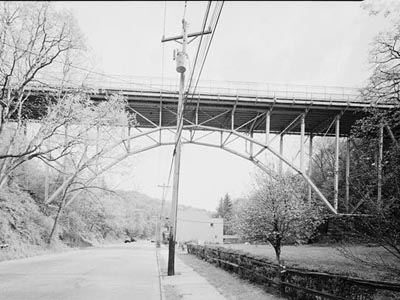
Historic American Engineering Record photo (view south) 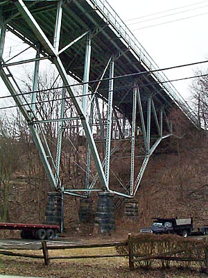
Western piers OFFICIAL NAME: Davis Avenue Bridge OTHER DESIGNATION: Davis Av over Woods Run pghw582-1 LOCATION: Pittsburgh USGS 7.5" Topo Quad - UTM Coordinates: Pittsburgh West - Zone 17; 0582 4481 CARRIES: Davis Av BETWEEN: -- Riverview Park --Laird St CROSSES: -- Woods Run; Woods Run Av TYPE OF CONSTRUCTION / DESIGN: steel deck cantilever arch LENGTH OF MAIN SPAN: 156 ft TOTAL LENGTH (including longest elevated ramp): 396 ft HEIGHT OF DECK: 70 ft clearance, below bottom chord at mid-span YEAR ERECTED / ENGINEER: 1898, City of Allegheny Department of Public Works Fabricator: Fort Pitt Bridge Works (Pittsburgh) Superstructure: Gustave Kaufman Substructure: C. M. Driver Current owner: City of Pittsburgh ADDITIONAL INFO: Closed to traffic 2001 Demolished 2009 view page - Davis Avenue Bridge -- Historic American Engineering Record document FIELD CHECKED: INFO SOURCES: field check; Historic American Engineering Record (HAER) Submit info or inquiry - share some facts or ask a question. Introduction -- Nearby Structures Page created: Last modified: 29-Jan-2004 04-Mar-2023 |
View Larger Map 
| |
| copyright: © Bruce S. Cridlebaugh 1999-2008 All Rights Reserved | |||