| Home > All By Location regional map > Pittsburgh West > West End Circle - Dumas St over Saw Mill Run | ||||
|
|
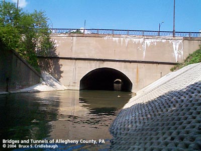
View east (downstream)
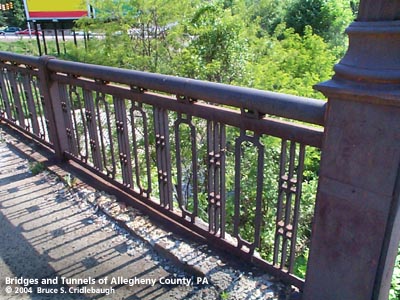
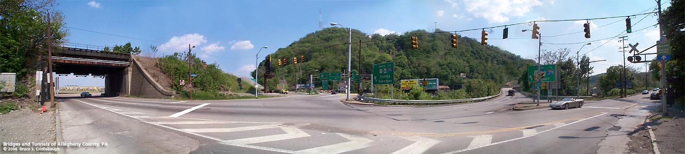
OFFICIAL NAME: OTHER DESIGNATION: West End Circle Dumas St over Saw Mill Run LOCATION: Pittsburgh USGS 7.5" Topo Quad - UTM Coordinates: Pittsburgh West - Zone 17; 0582 4477 CARRIES: Dumas St [PA60 SB] BETWEEN: -- Steuben St -- South Main St [PA60], merging with West End Bypass [US19, PA51] CROSSES: -- Saw Mill Run TYPE OF CONSTRUCTION / DESIGN: Closed spandrel concrete arch (culvert) LENGTH OF MAIN SPAN: 35 ft TOTAL LENGTH (including longest elevated ramp): HEIGHT OF DECK: YEAR ERECTED / ENGINEER: 1931, Allegheny County ADDITIONAL INFO: from the PennDOT Historic Bridges survey: The bridge carries 3 lanes of traffic over a stream at the City of Pittsburgh's West End Circle, north of the proposed West End Historic District. The bridge was designed at built by Allegheny County in the early 1930s as part of road realignments associated with the construction of the NR-listed West End Bridge (BMS 02006000040100). This is the western connection which completes the West End Circle. The other three "sides" of the circle had been in place at least 100 years earlier: South Main St [Pittsburgh and Noblestown Pike], West Carson St, and Steuben St [Chestnut St]. Construction of a reconfigured West End Circle area began in 2000. Scheduled to be completed by 2008, the new design calls for the closing and abandonment of Dumas St in favor of a new Steuben St Connector a few hundred feet to the west. view page - Other structures in the West End Valley FIELD CHECKED: 10-May-2004 INFO SOURCES: field check Submit info or inquiry - share some facts or ask a question. Introduction -- Nearby Structures Page created: Last modified: 13-Jul-2004 |
View Larger Map 
| ||
| copyright: © Bruce S. Cridlebaugh 1999-2008 All Rights Reserved | ||||