| Home > All By Location regional map > Pittsbugh East > Fort Wayne Railroad Bridge 1868 | ||||
|
|
Downstream left 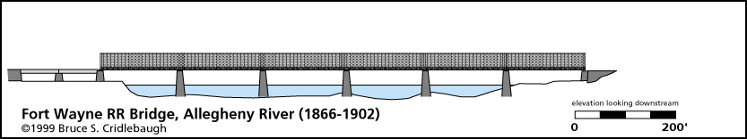
Elevation drawing looking downstream
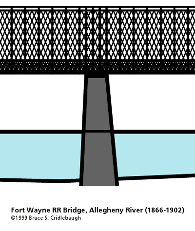
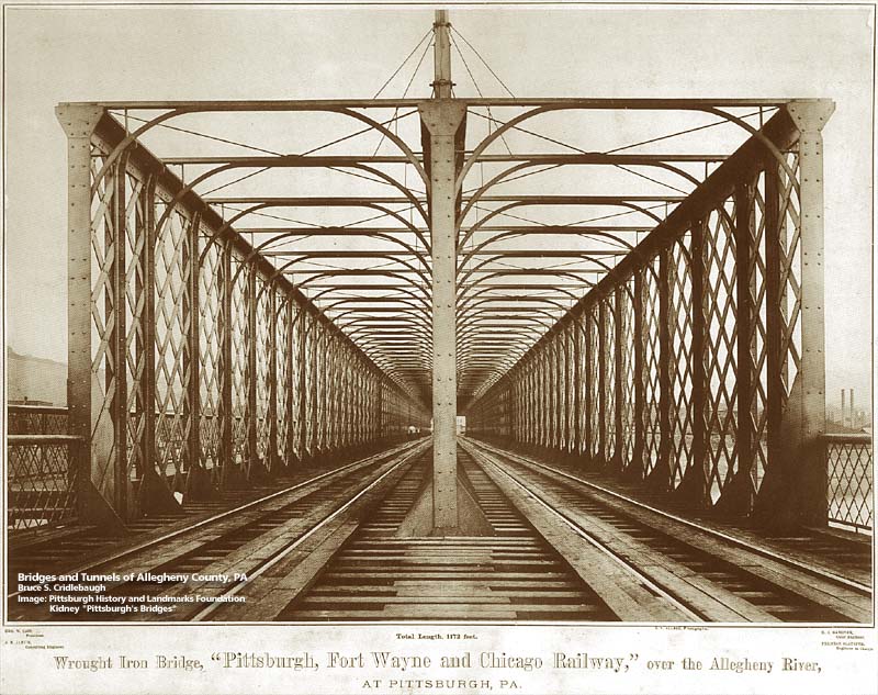
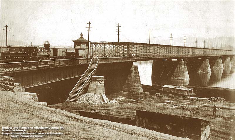
OFFICIAL NAME: OTHER DESIGNATION: Fort Wayne Railroad Bridge pghe585-12x4 LOCATION: Pittsburgh USGS 7.5" Topo Quad - UTM Coordinates: Pittsburgh East - Zone 17; 0585 4477 CARRIED: Pennsylvania Railroad (acquired from Pittsburgh, Fort Wayne and Chicago Railway) BETWEEN: -- near Hope St on right descending bank of Allegheny River -- near Eleventh St [Washington St] on left descending bank of Allegheny River CROSSED: -- Allegheny River at mile 1.0 TYPE OF CONSTRUCTION / DESIGN: iron lattice (rare iron Town lattice) LENGTH OF MAIN SPAN: TOTAL LENGTH (including longest elevated ramp): HEIGHT OF DECK: YEAR ERECTED / ENGINEER: 1868, Pittsburgh, Fort Wayne and Chicago Railroad ADDITIONAL INFO: This is the fourth bridge near this location. The first two bridges were aqueducts built to carry the Pennsylvania Canal (PA Mainline of Public Works) over the Allegheny River. They aligned with 11th St in the Triangle and Voeghtly St. on the Northside. As the railroad came to Pittsburgh, it was able to make the canal obsolete. The third bridge, built just downstream from the canal bridge, was a wooden structure built in 1857 for the Pittsburgh, Fort Wayne and Chicago Railroad. It completed the rail route from Chicago to Pittsburgh. Service from points west had been available in Allegheny City (Northside) previously, but due to political considerations, the link across the Allegheny River was delayed. The bridge was not opened until a year after its completion. The fourth bridge was a wrought iron lattice truss built completed in 1868 for the Pittsburgh, Fort Wayne and Chicago Railroad. It had 5 lattice truss spans and 2 plate girder simple spans at each approach. The iron lattice bridge was replaced by the current bridge, built for the railroad in 1901-04 by American Bridge Co. The lattice bridge remained in place during construction of the new bridge and the piers of the new bridge were extended from the piers of the old. The old piers have since been removed. FIELD CHECKED: INFO SOURCES: USACE Allegheny River Nav. Charts; National Park Service website, Kobus and Consoli, "The Pennsy in The Steel City" and "The Pennsylvania Railroad's Golden Triangle" Submit info or inquiry - share some facts or ask a question. Introduction -- Nearby Structures Page created: Last modified: 16-Nov-2000 |
View Larger Map 
| ||
| copyright: © Bruce S. Cridlebaugh 1999-2008 All Rights Reserved | ||||