| Home > All By Location regional map > Pittsbugh East > First Av "T" Station | ||||
|
|
First Ave at B St
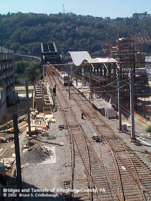
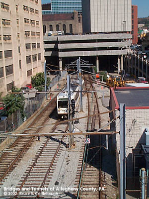
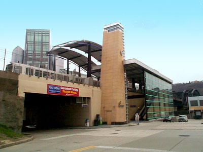
OFFICIAL NAME: First Avenue "T" Station OTHER DESIGNATION: Firstside "T" Station LOCATION: Pittsburgh USGS 7.5" Topo Quad - UTM Coordinates: Pittsburgh East - Zone 17; 0585 4476 CARRIES: access to Port Authority "T" Subway BETWEEN: -- First Avenue "T" station; First Av at Try St CROSSES: First Av TYPE OF CONSTRUCTION / DESIGN: -- LENGTH OF MAIN SPAN: TOTAL LENGTH (including longest elevated ramp): HEIGHT OF DECK: YEAR ERECTED / ENGINEER: 2001 Massaro Co, construction ADDITIONAL INFO: This rail line was part of the route built by the Pittsburgh and Steubenville Railroad Company, a division of the Pittsburgh, Cincinnati, Chicago and St. Louis Railroad. The "Steubenville Extension" was later absorbed into the Pensylvania Railroad. This line ran west to Steubenville, OH, crossing the "panhandle" of Virginia (West Virginia after the Civil War), thus the source of the nickname of the railroad and the bridge. view page - More info about Panhandle Bridge over Monongahela River Since 1985, this route has been used as part of the "T" light rail system operated by the Port Authority of Allegheny County. The above ground light rail vehicles cross the Panhandle Bridge, pass under several buildings and enter the PRR tunnel under Forbes Av -- thereby entering the Pittsburgh subway. The First Avenue Station opened November 16, 2001. The station stands between the Pittsburgh Parking Authority's six-floor garage and the PNC Operations Center, which were completed a year earlier. This station is part of the downtown free-ride zone which allows riders to travel between any of the downtown subway stations without charge. The station platform, three floors above street level, was constructed around the existing rail line. The current Panhandle Bridge which carries the "T" over the Monongahela River to the south, was built in 1903. It was raised up as part of a grade separation project, 1912-1914. At the north approach -- in the vicinity of the First Avenue Station -- Second Av and the BO Railroad were lowered and a series of plate girder spans were constructed to carry the Panhandle Division of the PRR from the bridge past Fourth St Station and into Tunnel No. 1 which leads to Pennsylvania Union Station at Liberty and 11th St. The station is near the south portal of the Pennsylvania Canal tunnel, lift locks along the present Try St (Front St, Second St, Fourth St) and the Mon River outlet. This area is also the former location of Pipetown at Suke's Run (also called Sucks Run). Nathaniel Greenough operated a shipyard here. The section of First Av (also known at Front St) east of Try St was once called Greenough St. FIELD CHECKED: INFO SOURCES: Submit info or inquiry - share some facts or ask a question. Introduction -- Nearby Structures Page created: Last modified: 08-April-2002 |
View Larger Map View Larger Map 
| ||
| copyright: © Bruce S. Cridlebaugh 1999-2008 All Rights Reserved | ||||