| Home > All By Location regional map > Monongahela > Monongahela City Bridge | ||||
|
|
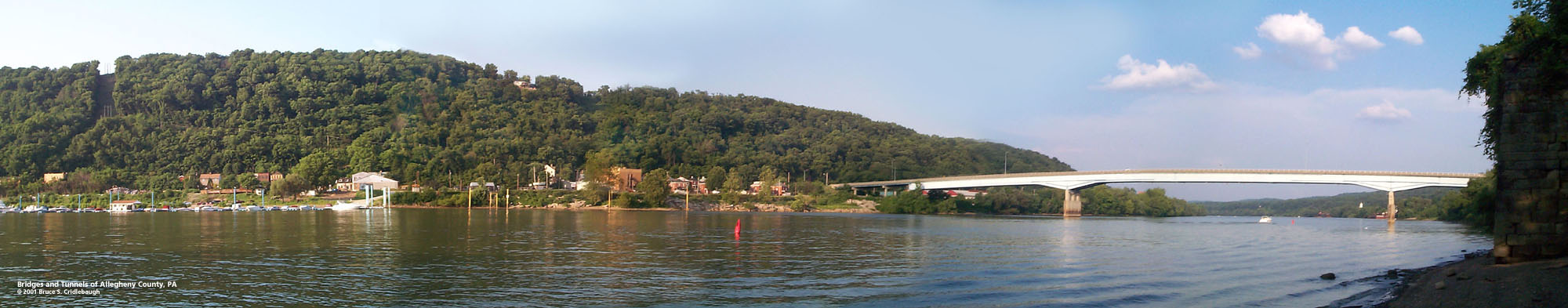
View south (upstream) 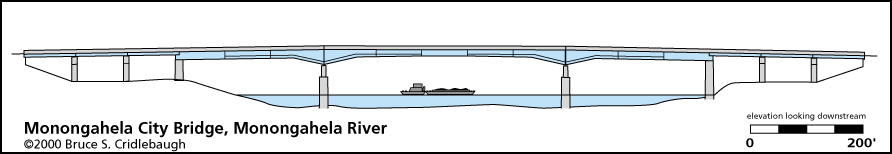
Elevation drawing looking downstream
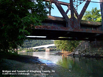
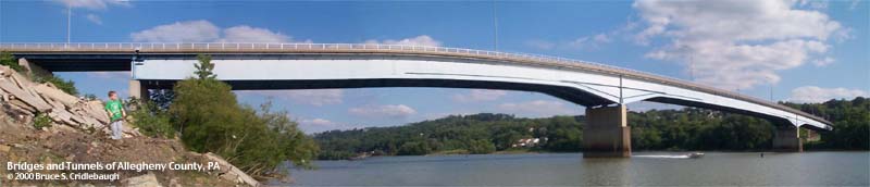
OFFICIAL NAME: OFFICIAL NAME: OTHER DESIGNATION: Monongahela City Bridge mono591-6 LOCATION: Monongahela, Washington Co. - Forward Twp., Allegheny Co. USGS 7.5" Topo Quad - UTM Coordinates: Monongahela - Zone 17; 0591 4450 CARRIES: motor vehicles, PA136 BETWEEN: -- Bunola River Rd [PA136] (Forward Twp., Allegheny Co.) on right descending bank of Monongahela River -- Cemetery Hill Rd [PA88] (Monongahela City, Washington Co.) on left descending bank of Monongahela River CROSSES: -- (RDB to LDB) CSX [PLE RR]; Monongahela River at mile 33.4; NS RR [Conrail]; East Main St [PA837] TYPE OF CONSTRUCTION / DESIGN: Welded girder with bolted splice plates; deck steel beam approach spans LENGTH OF MAIN SPAN: 440 ft est. TOTAL LENGTH (including longest elevated ramp): HEIGHT OF DECK: Lock and Dam No. 3, Elizabeth, normal pool level 726.9 ft YEAR ERECTED / ENGINEER: 1988, PennDOT ADDITIONAL INFO: The main superstructure of the bridge is very similar to the Clairton-Glassport bridge of a year earlier. It stands just upstream of the outflow of Pigeon Creek and Whiskey Point, a prominent site from the Whiskey Rebellion (1791-1794) where farmers and political leaders protested the Federal government's excise tax on whiskey. The location of the bridge may be close to the site of the first bridge, Williamsport Bridge, which replaced Parkinson's Ferry in 1836. (Some sources spell the name Parkison; others Parkinson.) Williamsport and Parkinson's Ferry were the previous names of the town; the name was changed to Monongahela City, April 1, 1837. Photos and drawings seem to indicate when the 1838 Williamsport Bridge was rebuilt after a fire in 1884, its replacement was a four span metal through truss. This bridge was, in turn, replaced in 1910 by another metal through truss of three spans which stood until 1988. FIELD CHECKED: 03-June-2000 INFO SOURCES: USACE Monongahela River Nav. Charts Submit info or inquiry - share some facts or ask a question. Introduction -- Nearby Structures Page created: Last modified: 29-Apr-2002 |
View Larger Map View Larger Map 
| ||
| copyright: © Bruce S. Cridlebaugh 1999-2008 All Rights Reserved | ||||