| Home > All By Location regional map > McKeesport > Boston Bridge 1893 | ||||
|
|
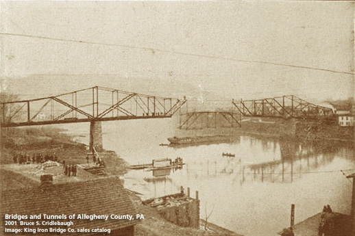
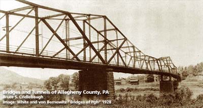
1893 photo (King Iron Bridge Co.)
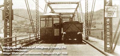
OFFICIAL NAME: OTHER DESIGNATION: Boston Bridge 1893 LOCATION: Boston (Elizabeth Twp) - Versailles USGS 7.5" Topo Quad - UTM Coordinates: McKeesport - Zone 17; 0599 4462 CARRIED: motor vehicles, two lanes street railway BETWEEN: -- (Versailles) on right descending bank of Youghiogheny River -- (Boston) on left descending bank of Youghiogheny River CROSSED: -- (RDB to LDB) B&O RR [current CSX RR]; Youghiogheny River at mile 4.1; P&LE RR [current Yough River Trail] TYPE OF CONSTRUCTION / DESIGN: iron cantilever through truss LENGTH OF MAIN SPAN: 350 ft, channel span; 150 ft shore arms TOTAL LENGTH (including longest elevated ramp): 650 ft 81 ft wide roadway, 5 ft wide sidewalk HEIGHT OF DECK: YEAR ERECTED / ENGINEER: 1893, King Iron Bridge Company ADDITIONAL INFO: FIELD CHECKED: INFO SOURCES: Abbott, et al, "First one hundred years of McKeesport"; White and Von Bernewitz "Bridges of Pittsburgh"; King Iron Bridge Co. sales catalog Submit info or inquiry - share some facts or ask a question. Introduction -- Nearby Structures Page created: Last modified: 31-Oct-2001 |
View Larger Map 
| ||
| copyright: © Bruce S. Cridlebaugh 1999-2008 All Rights Reserved | ||||