| Home > All By Location regional map > McKeesport > 13th Av Bridge 1892 | |||
|
|
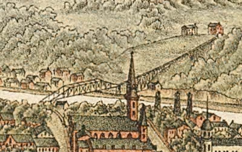
1893 drawing of bridge with incline 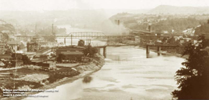
1913 view upstream on the Yough: 13th St in foreground, 15th St beyond OFFICIAL NAME: OTHER DESIGNATION: 13th Av Bridge LOCATION: McKeesport - Port Vue USGS 7.5" Topo Quad - UTM Coordinates: McKeesport - Zone 17; 0596 4465 CARRIED: motor vehicles, two lanes street railway BETWEEN: -- 13th Av (McKeesport) on right descending bank of Youghiogheny River -- River Rd (Port Vue), Port Vue Incline on left descending bank of Youghiogheny River CROSSED: -- (RDB to LDB) Youghiogheny River TYPE OF CONSTRUCTION / DESIGN: Pratt through truss LENGTH OF MAIN SPAN: TOTAL LENGTH (including longest elevated ramp): HEIGHT OF DECK: YEAR ERECTED / ENGINEER: 1892 ADDITIONAL INFO: FIELD CHECKED: INFO SOURCES: Abbott, et al, "First one hundred years of McKeesport"; USACE Monongahela River Nav. Charts Submit info or inquiry - share some facts or ask a question. Introduction -- Nearby Structures Page created: Last modified: 25-Oct-2000 |
View Larger Map 
| |
| copyright: © Bruce S. Cridlebaugh 1999-2008 All Rights Reserved | |||