| Home > All By Location regional map > McKeesport > P&LE RR Bridge over Youghiogheny River c1881 | |||
|
|
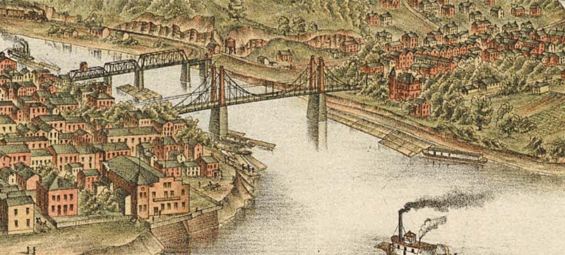
1893 drawing (through truss in background) 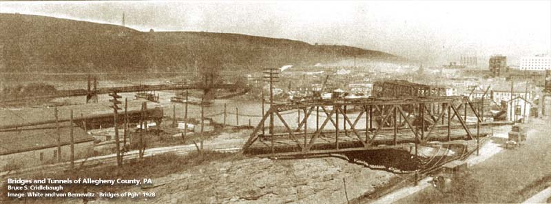
1928 photo (PLE bridge is beyond the highway through truss in the foreground) OFFICIAL NAME: OTHER DESIGNATION: P&LE RR Bridge over Yough LOCATION: McKeesport - Reynoldton USGS 7.5" Topo Quad - UTM Coordinates: McKeesport - Zone 17; 0595 4467 CARRIED: P&LE RR BETWEEN: -- P&LE RR [Pittsburgh, McKeesport and Youghiogheny RR] on right descending bank of Monongahela River -- P&LE RR [Pittsburgh, McKeesport and Youghiogheny RR] on left descending bank of Youghiogheny River with connection to McKeesport and Belle Vernon RR on right descending bank of Monongahela River [Belle Vernon Junction] CROSSED: -- (RDB to LDB) Water St; Youghiogheny River at mile 0.3; River Rd TYPE OF CONSTRUCTION / DESIGN: 3 Pratt through trusses and deck girder spans LENGTH OF MAIN SPAN: TOTAL LENGTH (including longest elevated ramp): HEIGHT OF DECK: YEAR ERECTED / ENGINEER: c1881, Pittsburgh, McKeesport and Youghiogheny RR ADDITIONAL INFO: Replaced by current structure. This location was once know as Belle Vernon Junction because of the railroad which branched off here, heading upriver to Belle Vernon. The bridge was built for the McKeesport and Belle Vernon RR which became part of the Pittsburgh, McKeesport and Youghiogheny Railroad ("P-Mickey"), incorporated in 1881. The PMcK became part of the Pittsburgh and Lake Erie RR under a 999-year lease. The P&LE was later folded into the Penn Central. It is currently owned by CSX. FIELD CHECKED: INFO SOURCES: Abbott, et al, "First one hundred years of McKeesport"; Beal, "McKeesport Trolleys" ; Jason Togyer Submit info or inquiry - share some facts or ask a question. Introduction -- Nearby Structures Page created: Last modified: 13-Nov-2000 |
View Larger Map 
| |
| copyright: © Bruce S. Cridlebaugh 1999-2008 All Rights Reserved | |||