| Home > All By Location regional map > McKeesport > P&LE Bridge McKeesport | ||||
|
|
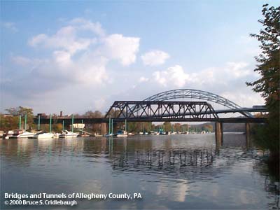
View west from marina on Water St
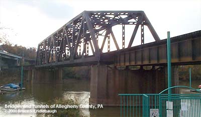
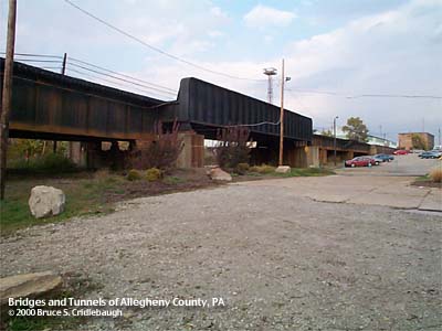
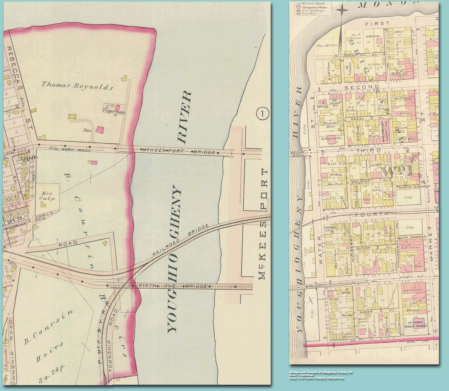
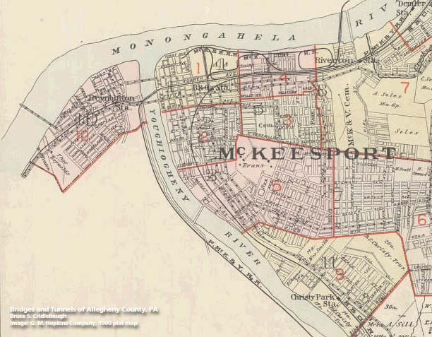
OFFICIAL NAME: OTHER DESIGNATION: P&LE Bridge over Yough at McKeesport LOCATION: McKeesport USGS 7.5" Topo Quad - UTM Coordinates: McKeesport - Zone 17; 1595 4467 CARRIES: CSX [P&LE] railroad, two tracks P&LE milepost 15; CSX milepost 314 CSX Cumberland division, Pittsburgh subdivision BETWEEN: -- CSX on right descending bank of Monongahela River -- CSX on left descending bank of Youghiogheny River with branch line of CSX on right descending bank of Monongahela River CROSSES: -- (RDB to LDB) Water St; Youghiogheny River at mile 0.3; River Rd TYPE OF CONSTRUCTION / DESIGN: Pratt through truss and deck girder spans LENGTH OF MAIN SPAN: 248.0 ft TOTAL LENGTH (including longest elevated ramp): HEIGHT OF DECK: 31.0 ft, vertical clearance, channel span YEAR ERECTED / ENGINEER: 1968, Pittsburgh and Lake Erie RR CSX, current owner ADDITIONAL INFO: Replaced an earlier bridge built as part of the Pittsburgh, McKeesport and Youghiogheny RR. This bridge, in combination with the 1968 CSX Bridge over the Youghiogheny at Liberty Boro, allowed the removal of the former B&O RR tracks through the heart of McKeesport. The B&O RR tracks cut an arc diagonally through the heart of McKeesport. They curved to meet Fourth Av at the B&O station between Locust and Sinclair Streets. North of this location, the tracks of the P&LE RR (former Pittsburgh, McKeesport and Youghiogheny RR) converged with other lines to completely fill Fourth Av (McKeesport and Bessemer RR; McKeesport Connecting RR). Until the last train in 1970, the B&O tracks plagued the downtown area with numerous grade crossings and constant delays. In 1968, this P&LE bridge at McKeesport and a new bridge up the Yough at Liberty Boro allowed train traffic to continue along Fourth Av to the left bank of the Youghiogheny River. Map - Bridges over the Yough at McKeesport, 1900 Hopkins plat map Map - McKeesport, 1900 Hopkins plat map index FIELD CHECKED: 23-Oct-2000 INFO SOURCES: USACE Monongahela River Nav. Charts; Abbott, et al, "First one hundred years of McKeesport"; 1900 Hopkins map Submit info or inquiry - share some facts or ask a question. Introduction -- Nearby Structures Page created: Last modified: 10-Nov-2000 |
View Larger Map 
| ||
| copyright: © Bruce S. Cridlebaugh 1999-2008 All Rights Reserved | ||||