| Home > All By Location regional map > Glassport > Clairton-Glassport Bridge | ||||
|
|
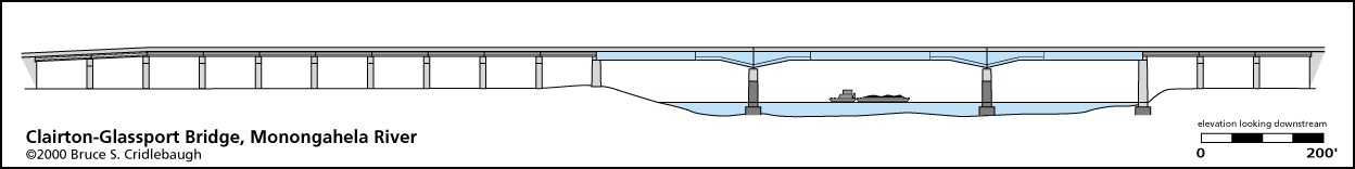
Elevation drawing looking downstream
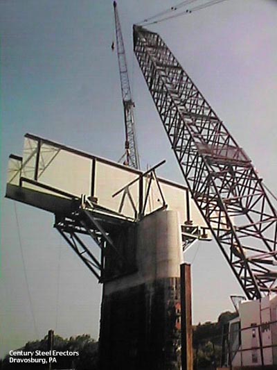
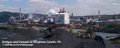
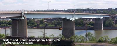
OFFICIAL NAME: OTHER DESIGNATION: Clairton-Glassport Bridge Glassport-Clairton Bridge Clairton Bridge Glassport Bridge glas594-12 LOCATION: Clairton - Glassport USGS 7.5" Topo Quad - UTM Coordinates: Glassport - Zone 17; 0594 4462 CARRIES: motor vehicles BETWEEN: -- right descending bank of Monongahela River; Monongahela Av, Glassport -- left descending bank of Monongahela River; State St, Clairton CROSSES: -- (RDB to LDB) CSX [PLE RR]; Monongahela River at mile 19.3; USX Clairton Coke Works; Union RR; NS RR [Conrail] TYPE OF CONSTRUCTION / DESIGN: Welded girder with bolted splice plates; deck concrete beam viaducts LENGTH OF MAIN SPAN: 385.6 ft TOTAL LENGTH (including longest elevated ramp): 2,890 ft HEIGHT OF DECK: Lock and Dam No. 2, Braddock, normal pool level 718.7 ft YEAR ERECTED / ENGINEER: 1987, PennDOT ADDITIONAL INFO: Modern bridges typically look like, well, modern bridges. And this modern structure crosses the river in seven massive girder sections (3 stringers wide), where since 1928 a much more complicated spandrel-braced arch had stood. Signs of the previous structure still remain in the river piers. Reminiscent of the Washington Monument which was stalled during construction and resumed using stone which didn't match, these river piers rise from the water as the original stone columns. Half again the height of the exposed stone, each pier is extended in concrete to carry the new girders. At each end, concrete beam stringers rest on concrete hammerhead piers to carry short, simple spans to the steel girder section. On the Glassport side, there are 3 of these spans; in Clairton, a viaduct of 10 short spans extend the roadway over the USX Clairton Coke Works and down to a landing at State St. The construction photo is from Century Steel Erectors of Dravosburg, PA. FIELD CHECKED: 03-June-2000 INFO SOURCES: USACE Monongahela River Nav. Charts Submit info or inquiry - share some facts or ask a question. Introduction -- Nearby Structures Page created: Last modified: 15-June-2000 |
View Larger Map View Larger Map View Larger Map 
| ||
| copyright: © Bruce S. Cridlebaugh 1999-2008 All Rights Reserved | ||||