| Home > All By Location regional map > Glassport > Triphammer Rd over Piney Fork | ||||
|
|
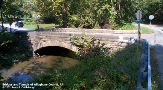
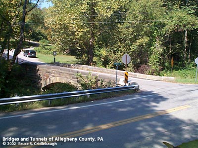
View north (upstream) with Piney Fork Rd to right
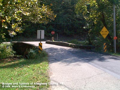
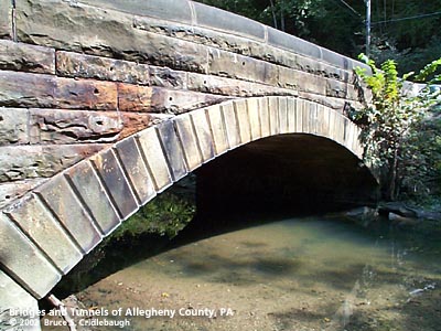
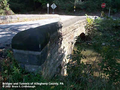
OFFICIAL NAME: OTHER DESIGNATION: Triphammer Rd over Piney Fork, at Piney Fork Rd glas586-24 LOCATION: South Park Twp USGS 7.5" Topo Quad - UTM Coordinates: Glassport - Zone 17; 0586 4459 CARRIES: -- Triphammer Rd BETWEEN: -- Piney Fork Rd, between Single Track Rd and Ridge Rd CROSSES: -- Piney Fork TYPE OF CONSTRUCTION / DESIGN: stone arch locally-quarried sandstone outer spandrel wall: rock-faced coursed ashlar upper walls and parapets: dressed coursed ashlar arch ring: dressed voussoirs in segmental arch LENGTH OF MAIN SPAN: 29 ft TOTAL LENGTH (including longest elevated ramp): 62 ft 15.5 ft wide, between parapets HEIGHT OF DECK: YEAR ERECTED / ENGINEER: 1902, Allegheny County Charles Davis, County Engineer ADDITIONAL INFO: This bridge exhibits the more common design features of the County's stone bridges -- parapets with rounded top and horizontal curves at the portals. Across Piney Fork Rd from this bridge there are indications of a stone quarry which may have been the source of the sandstone used in this structure. The 1876 Hopkins map does not show the name "Triphammer," but shows an Axe Factory located at the west end of the bridge site. Just south of this bridge on Triphammer Rd is an access point for the Montour Trail, a "rails-to-trails" conversion of the Montour Railroad and PRR Peters Creek Branch. Piney Fork is a tributary of Peters Creek. Piney Fork flows from Bethel Park eastward through Library where the former Montour Railroad joins the creek valley. The watercourse continues to wind eastward past Triphammer Rd to meet Peters Creek near Snowden and the interchange with the former Pennsylvania Railroad branch that connects to the Monongahela River at Clairton. FIELD CHECKED: 28-Sep-2002 INFO SOURCES: field check Submit info or inquiry - share some facts or ask a question. Introduction -- Nearby Structures Page created: Last modified: 09-Oct-2002 |
View Larger Map View Larger Map 
| ||
| copyright: © Bruce S. Cridlebaugh 1999-2008 All Rights Reserved | ||||