| Home > All By Location regional map > Emsworth > Pedestrian bridge over Lowrie's Run | ||||
|
|

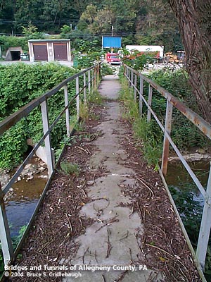
View northeast toward Atlantic Av (downstream right)
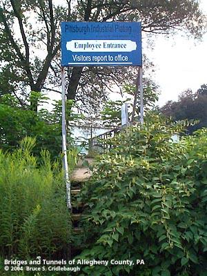
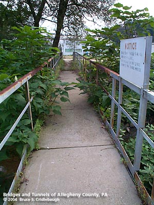
OFFICIAL NAME: OTHER DESIGNATION: Pedestrian bridge over Lowrie's Run LOCATION: Emsworth USGS 7.5" Topo Quad - UTM Coordinates: Emsworth - Zone 17; 0577 4484 CARRIES: pedestrians BETWEEN: -- Atlantic Av -- Pittsburgh Industrial Plating CROSSES: -- Lowrie's Run TYPE OF CONSTRUCTION / DESIGN: Deck steel girder LENGTH OF MAIN SPAN: TOTAL LENGTH (including longest elevated ramp): 80 ft est HEIGHT OF DECK: YEAR ERECTED / ENGINEER: ADDITIONAL INFO: FIELD CHECKED: 14-Aug-2004 INFO SOURCES: field check Submit info or inquiry - share some facts or ask a question. Introduction -- Nearby Structures Page created: Last modified: 28-Sep-2004 |
View Larger Map View Larger Map 
| ||
| copyright: © Bruce S. Cridlebaugh 1999-2008 All Rights Reserved | ||||